Another day, another round of storms.
After a pleasant but humid Monday, the chance for showers increases after sunset. Then the severe threat arrives in the tri-state after midnight and into early Tuesday morning.
The biggest thing to brace for is the potential for heavy rain and flash flooding, which could potentially wreak havoc on the morning commute. The flash flooding could become problematic for those who live in areas that frequently see water levels rise amid bouts of heavy rain.
The greatest risk for damaging winds, even a tornado or two, will be closer to the Philadelphia metro area, but not out of the question for areas in and around New York City.
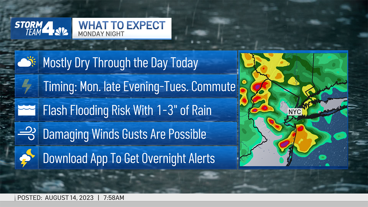
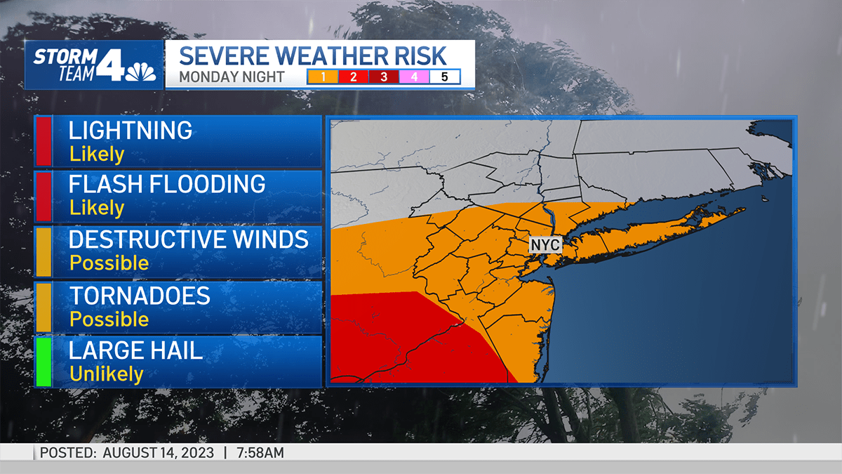
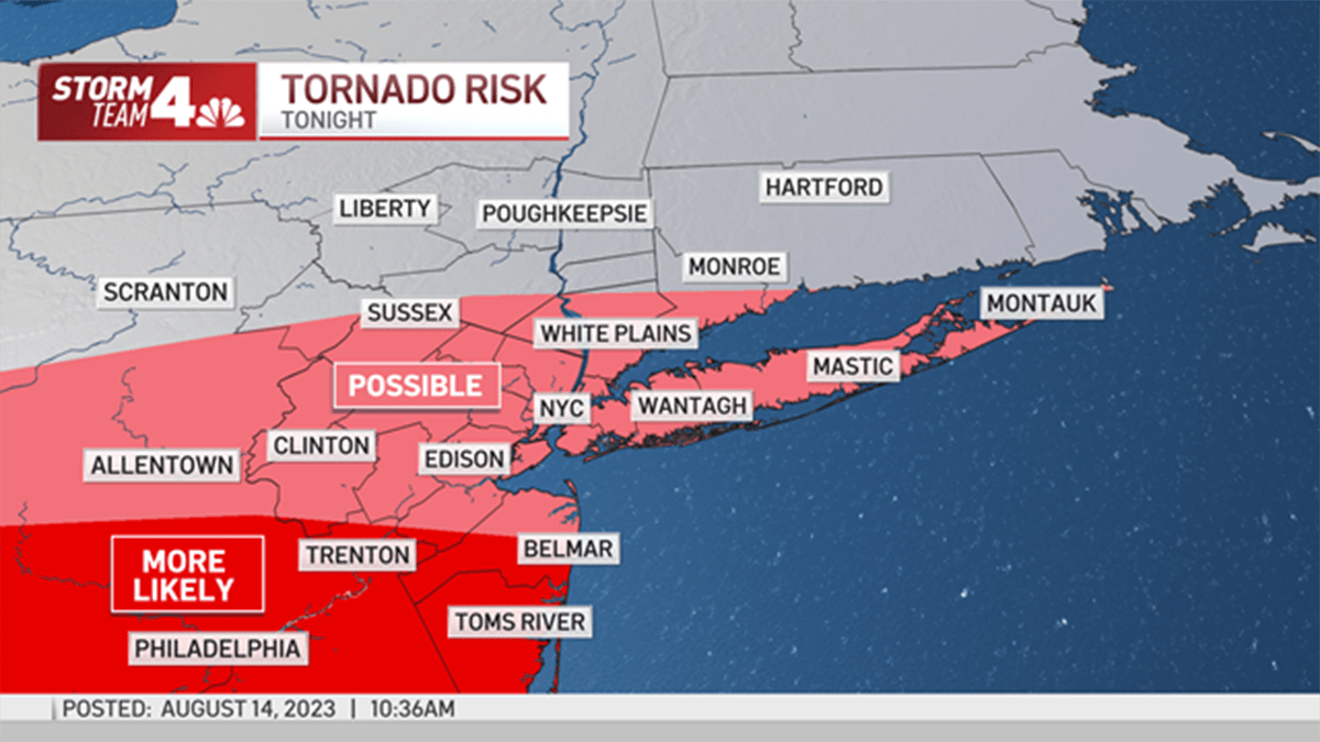
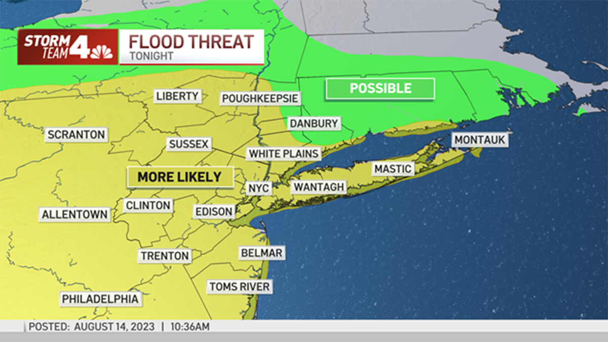
As far as timing goes, the worst of the weather will start to arrive by midnight.
And how long will the storms last? Likely until around the Tuesday morning commute, so you may need to sport a rain coat or umbrella on the way to work — but not just for the morning. After a midday break, more storms are possible during the afternoon and evening.
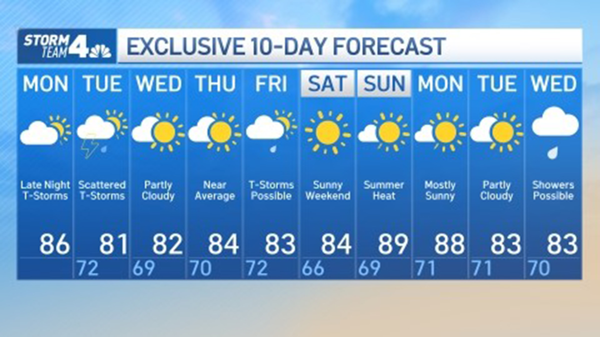
The rest of the work week looks primarily clear, with mostly sunny skies and highs in the low to mid 80s. Then storms close out the week on Friday before another front clears out the area for the weekend.
See Storm Team 4’s exclusive 10-day forecast below:

0 Comments