What to Know
- On Saturday, some of the showers could be heavy at times with the greatest flood risk setting up from the Hudson Valley, near New York City and into western Connecticut.
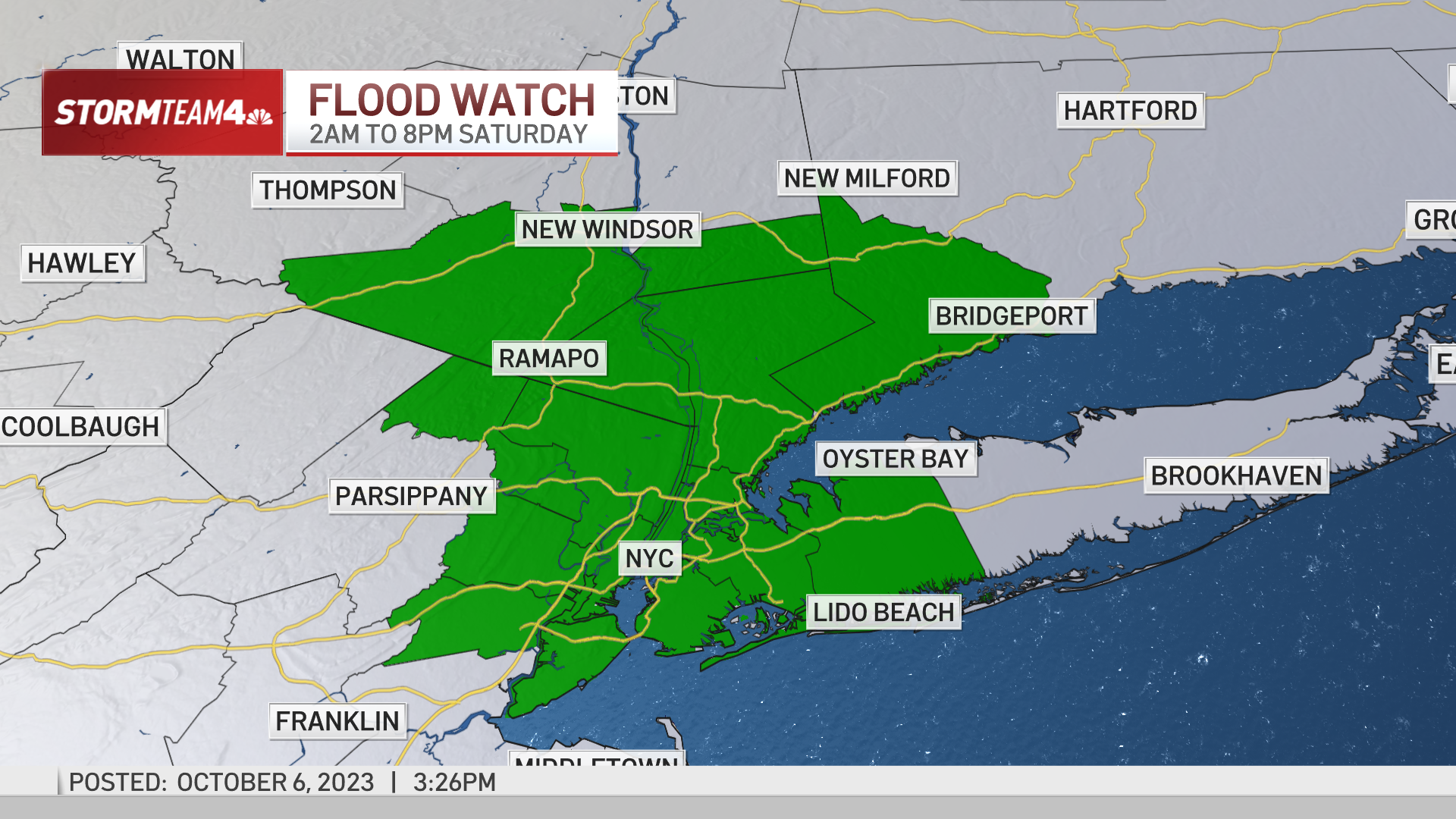
- A flood watch has been issued for the NYC metro area, lower Hudson Valley, and Fairfield County, Conn.
- However, there is some good news as a bit of sun returns Sunday — although with persistent gusts of 25+ mph.
A flood watch is in effect for Saturday with the possibility of a weather front bringing a couple of inches of rain to some in the NYC area.
Some of the Saturday showers could be heavy at times with the greatest flood risk setting up from the Hudson Valley, near New York City and into western Connecticut.
A flood watch has been issued for the NYC metro area, lower Hudson Valley, and Fairfield County, Conn. for 2 a.m. to 8 p.m. Saturday.
However, as of Saturday morning, rain has been well below expectations so far. The heaviest rain so far has been in Orange County where flood advisories are currently in place. Meanwhile, a flash flood watch was issued for Sullivan County until 1 p.m. Saturday.


Most of the heavy rainfall should end by late afternoon/early evening Saturday. The rainfall does not look to bring the same kind of intensity that descended on the NYC area one week ago, with the 1-2 inch hourly rainfall totals; rather this will be a cumulative effect. Some people could still see 0.25-0.50 inches per hour through the morning, adding up to 2-4 inches by midday.
The winds will also pick up on Saturday with chilly gusts through Sunday.
The threat of heavy rain and potential flooding over the weekend prompted Gov. Kathy Hochul to urge New Yorkers to prepare for severe weather in certain areas across eastern New York state, as a “strong, slow-moving cold front is expected to bring showers and isolated thunderstorms starting today and continuing through Saturday in the Capital, Central New York, Long Island, Mid-Hudson, Mohawk Valley, New York City, and North Country regions.”
The governor’s office warns of up to three inches of rain are expected but excessive rainfall of up to five inches in some places could lead to flooding and isolated flash flooding. Most areas will receive around two inches, according to Storm Team 4.
“We are keeping a close eye on a strong weather system that has the potential to dump more rain and cause more flooding this weekend in areas that are still recovering from last week’s storms,” Hochul said in a statement.

New York City Eric Adams, who is traveling through Central and Latin America, too to social media to also warn about the possibility of severe weather this weekend, saying the city has activated its “Flash Flood Emergency Plan.”
This comes as the mayor faced criticism the city’s response when it came to last week’s floods.
After relentless rain suspended service on several transit lines, NYC Comptroller Brad Lander launches an investigation to see where the city went wrong.
Rain walloped the New York metropolitan area with a startling punch last Friday, Sept. 29, knocking out several subway and commuter rail lines, stranding drivers on highways, flooding basements and shuttering a terminal at LaGuardia Airport for hours in one of the city’s wettest days in decades.
Almost 7 inches of rain had fallen in parts of Brooklyn by midday, with at least one spot seeing 2.5 inches in a single hour, according to weather and city officials. The nearly 8 inches at John F. Kennedy Airport surpassed its record for any September day, a bar set during Hurricane Donna in 1960, the National Weather Service said.
City officials said they got reports of six flooded basement apartments Friday, but all occupants got out safely.
Gov. Kathy Hochul and Mayor Eric Adams declared states of emergency and urged people to stay put if possible. But schools were open, students went to class and many adults went to work, only to wonder how they would get home.
Virtually every subway line was at least partly suspended, rerouted or running with delays. Metro-North commuter rail service from Manhattan was suspended for much of the day but began resuming by evening. The Long Island Rail Road was snarled, 44 of the city’s 3,500 buses got stranded and bus service was disrupted citywide, transit officials said.
This weekend’s rain is not expected to be on the scale of the rain from a week ago, but flash flooding remains possible, especially with saturated areas.
However, looking ahead, there is some good news in the forecast as a bit of sun returns Sunday — although with persistent gusts of 25+ mph.
Moving into next week, it will be mostly dry until more possible weekend rain. But it will be much cooler with lows in the 40s possible for NYC.

This story uses functionality that may not work in our app. Click here to open the story in your web browser.

0 Comments