
It’s going to continue to feel a lot like winter, instead of spring, in the tri-state area this week.
Tuesday so far has been filled with blue skies and sunshine. But, while sun may warm your soul, you’ll still need a winter coat: Temperatures will remain chilly and the wind picks up.
Air temperatures on Tuesday will stay in the 40s, but once you factor in wind gusts from 30 to 40+ mph, it’s going to feel like the 30s all day and the 20s overnight – definitely more like winter than spring.
Temperatures are around 10 degrees chillier than the average for today.
But as cold as Tuesday is going to feel, Wednesday morning will be the coldest period this week. Wind chills will dip into the low 20s for most, teens for others. The cold will be a shock to the system if you aren’t properly dressed in morning, so be sure to wear all the layers.

Thankfully, temperatures will bounce back to near 50 degrees by the afternoon, the wind will relax and we will continue with sunny skies. Feel free to shed a layer or two and get outside. Wednesday afternoon could turn out to be one of the nicest times of the week.
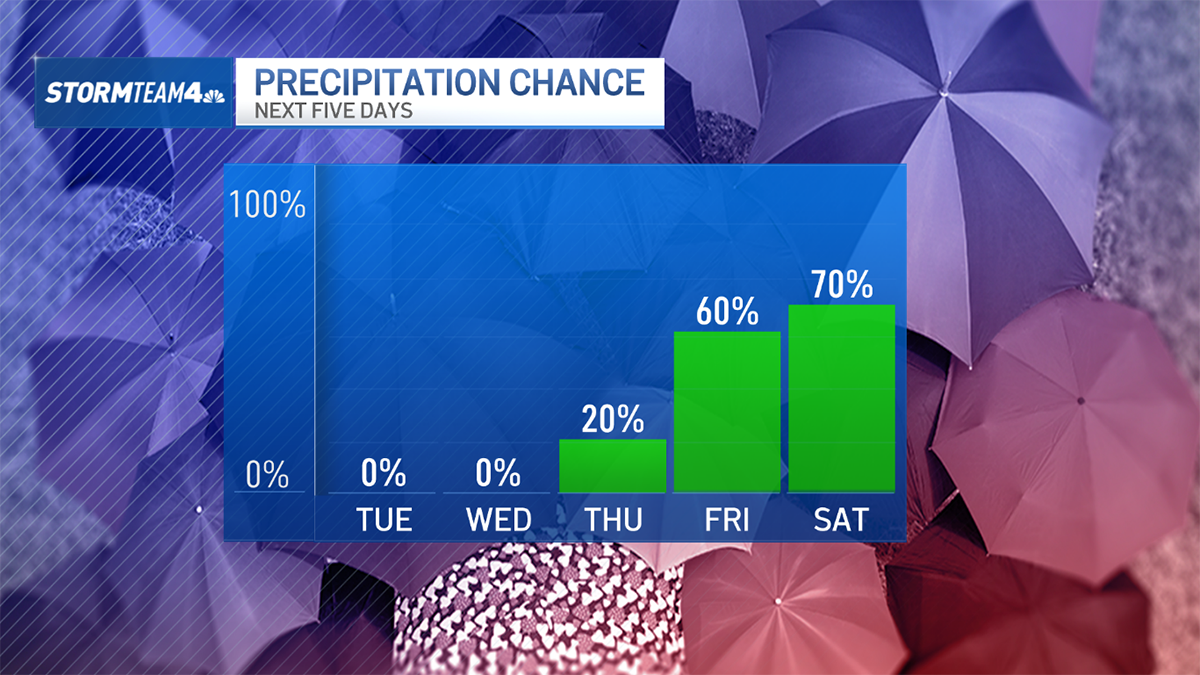
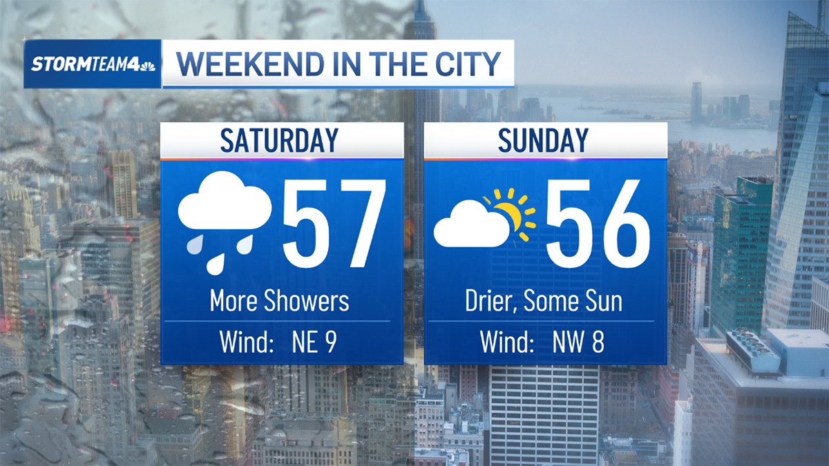
After a dry mid-week stretch, showers could return as early as Thursday and rain chances will ramp up through the first half of the weekend. The wet weather comes with a meager warm-up, but it’s nothing to write home about. We won’t crack into the 60s until after the weekend.
But when we do warm up, it’ll be glorious. Temperatures will climb well into the 60s, the sun should shine — and this time it has a little more staying power behind it.
Hang in there until the weekend when we start to turn the corner and then wait for those springlike temps next week.


0 Comments